The Analysis of the Demolition at Khamisiyah
On July 24, 1997, the DOD and CIA completed the analysis of the demolition
at Khamisiyah which occurred on March 10, 1991. The analysis includes:
- The Department of Defense Public Affairs office press release, July 24, 1997
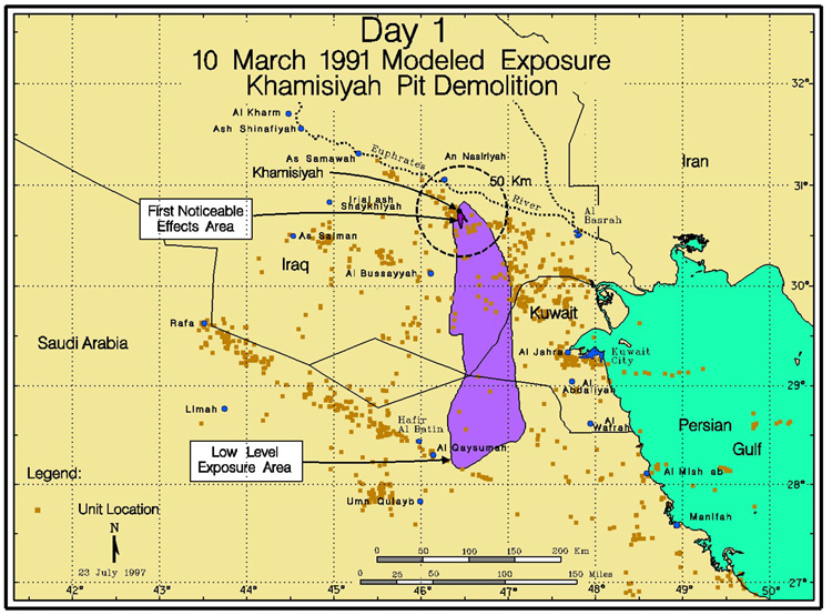
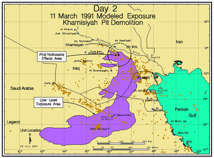
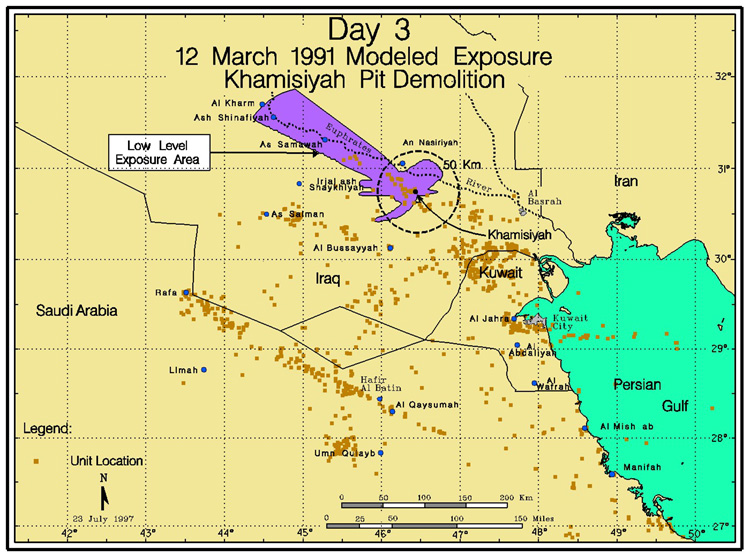
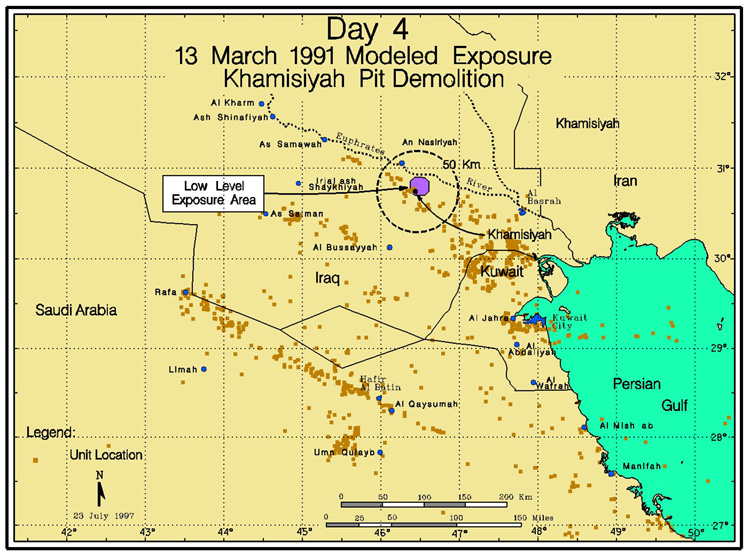
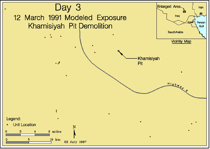
- Four maps depicting the direction and extent of potential low level chemical nerve
agent fallout for March 10,
11, 12, and
13. Each area of fallout is linked to a consolidated list of units possibly exposed to a low level of nerve agent. Four additional maps showing latitude and longitude are available for March 10, 11, 12 and 13.
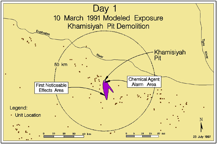
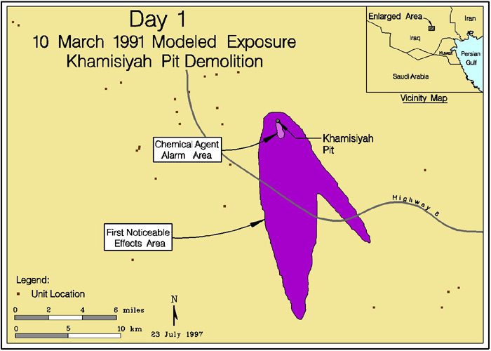
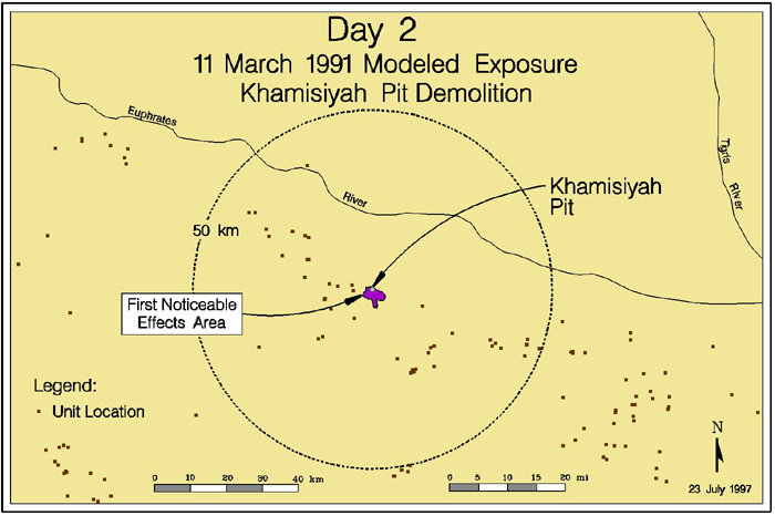
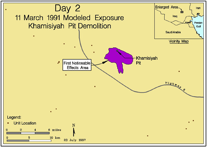
- Five maps depicting the first noticeable effects fallout areas immediately around Khamisiyah,
March 10, map a and map b;
March 11, map a and map b;
March 12. No units have been identified as being located
in the first noticeable effects fallout areas.
- A consolidated unit list of potential low level chemical nerve agent exposure for the period March 10 thru 13, 1991.
- Summary of Low Level chemical exposure, July 23,
1997.
- Fact Sheet on Exposure Limits For Sarin(GB), July 1997
- Research relevant to Gulf War Veterans on the Health effects
of nerve and mustard agents, July 1997.
- Veterans notification letters (examples);
- Located in the vicinity of Khamisiyah, but not exposed
to nerve agents.
- Located in the vicinity of Khamisiyah where the exposure
to a very low level of nerve agents was possible.
- Institute for Defense Analyses report detailing the release of nerve agents associated with the demolition at Khamisiyah, July 9, 1997.
- Khamisiyah Narrative, April 14, 1997.
- CIA White Paper, April 2, 1997.
| Return to GulfLINK | Return to Reports |